Tesla Pivots to In-House Maps for FSD Amidst Navigation Flaws
The electric vehicle maker is developing its own mapping architecture to address persistent speed limit and routing errors, a significant departure from its earlier camera-only strategy.
By Michael Lombardi ·
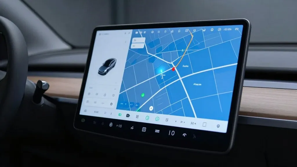
Tesla is currently developing its own proprietary mapping system to address recurring issues with its Full Self-Driving software. The company announced this strategic shift on its Q3 2026 earnings call, with the head of AI detailing how the new infrastructure will handle tasks that the current vision system struggles to perform reliably. This move directly targets problems with reading speed limits, managing parking, and selecting efficient routes for drivers.
The decision marks a notable departure from the company's long-standing public stance. For years, Tesla leadership has argued that self-driving systems reliant on pre-mapped data are fragile and less capable than pure vision-based approaches. However, the new plan effectively places Tesla's fleet in a similar role to Waymo's vehicles, using on-road data to create a comprehensive map that informs the driving system about environmental details it cannot consistently deduce on its own.
The initiative was triggered by direct feedback from shareholders during a recent question and answer session. One retail investor highlighted that mapping remains a significant pain point for FSD users, specifically citing speed limit recognition, parking difficulties, and route selection as the primary complaints. The investor questioned why the company continued to depend on third-party navigation data rather than building its own solution.
Ashok Elluswamy, Tesla’s VP of AI, confirmed the company's intention to reduce its reliance on external providers. He stated that the team is constructing a new mapping and navigation architecture powered by AI. This system will utilize data collected collectively from the Tesla fleet to improve overall performance. Additionally, the new technology is designed to learn individual driver preferences and respond to voice commands, creating a more personalized navigation experience.
The rollout of this technology is already underway with the latest software update. Elluswamy explained that the new map layer will initially handle the start and end points of trips within FSD version 15. Over the coming months, the system is expected to take over broader navigation tasks, including parking management and destination handling, as the data set continues to expand and refine.
This development follows a turbulent history for Tesla regarding high-precision mapping. When Autopilot launched in 2015, the company indicated it was building detailed maps with significantly higher granularity than standard navigation tools. However, during its 2019 Autonomy Day event, Elon Musk declared that relying on such maps was a major mistake that made the system brittle. He famously dismissed lidar as a foolish errand, reinforcing the idea that Tesla could solve driving with cameras and AI alone.
Critics argue that the current challenges highlight the limitations of the vision-only approach. Recent findings from a Belgian road safety group showed that FSD vehicles exceeded speed limits in 55 percent of tested zones in Brussels, often because the car’s display showed an incorrect limit. Meanwhile, the US National Highway Traffic Safety Administration is considering an investigation into reports that Tesla Robotaxis speed through active school zones, a concern covering roughly 1,000 Model Y and Cybercab vehicles.
The new mapping strategy brings Tesla’s operational model closer to that of its competitors. Waymo uses sensor-equipped vehicles to map cities before launching service, a process Tesla is now emulating with its fleet data. While Tesla is not currently focusing on centimeter-level high-definition maps, the gradual addition of detail from millions of vehicles could lead in that direction. This approach also aligns with the current city-by-city, geofenced rollout of Tesla’s Robotaxi service.
As Tesla integrates this new map layer, the focus remains on improving the accuracy of environmental understanding. The company aims to leverage the collective data of its large fleet to create a robust advantage in autonomous driving. If successful, the new system could mitigate the most common user complaints and enhance safety for everyone on the road, signaling a pragmatic adjustment to the company's long-term autonomy goals.
Source: Electrek · original report published